Flood of the century in Czechoslovakia
A magyar nyelvű cikkhez kattintson ide.
Or the disaster that brought not only people together, but also the fox and the rabbit.
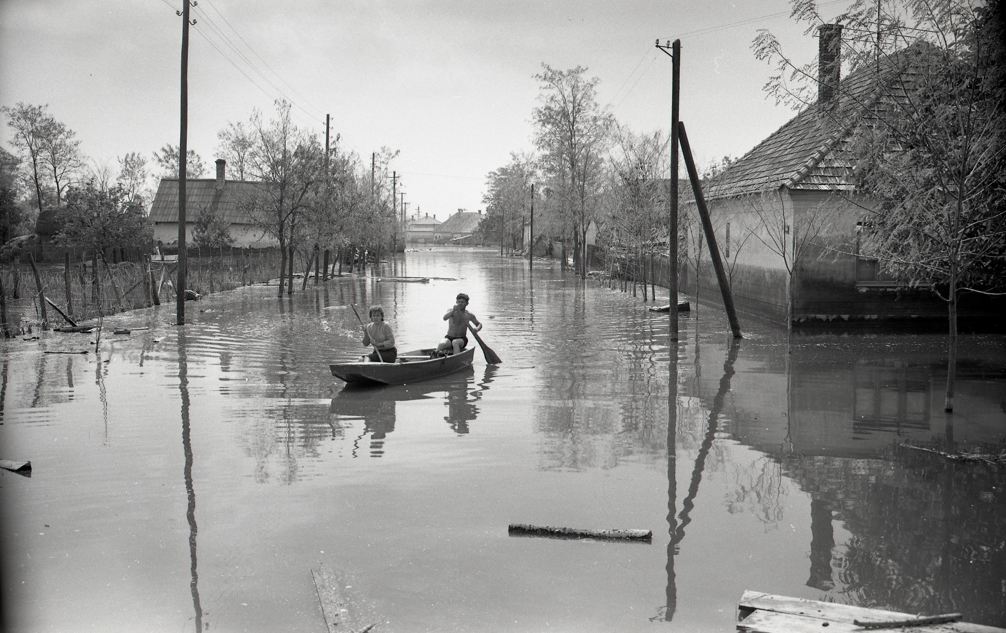
On June 17, 1965 – exactly 60 years ago – a dam burst near the village of Kulcsod, just 20 kilometers from Győr, in what is today Slovakia. It caused the largest natural disaster in the history of Czechoslovakia. The evacuation of the population and livestock was a true logistical feat, and the reconstruction became an extraordinary example of human dignity and solidarity. It is almost a miracle that the flood did not claim a single human life.
Based on interviews with survivors, we try to convey what it must have been like to live through it all. The year 1965 marks a turning point in the history of Csallóköz in every sense. The water not only took things away but also brought about or accelerated a series of social changes. In the memory of those who lived there, this date remains a reference point and a boundary between eras to this day: events either happened before the water or after.
"After Tany, I noticed a strange smell. The Danube has a distinctive scent, but to smell it already at Füss or Tany? And then, suddenly, I saw the water. I couldn't enter the village anymore. The bridge over the Keszi canal was immediately washed away by the water."
- This is how Nándor Kiss from Csicsó recalls how he was confronted with the disaster.
He was just about to return home on his motorcycle after bringing his pregnant wife to safety in Nagyölved. The distinctive scent of the Danube continued to define the daily lives of 50,000 people in Csallóköz for a long time afterward.
The Danube gives and takes away
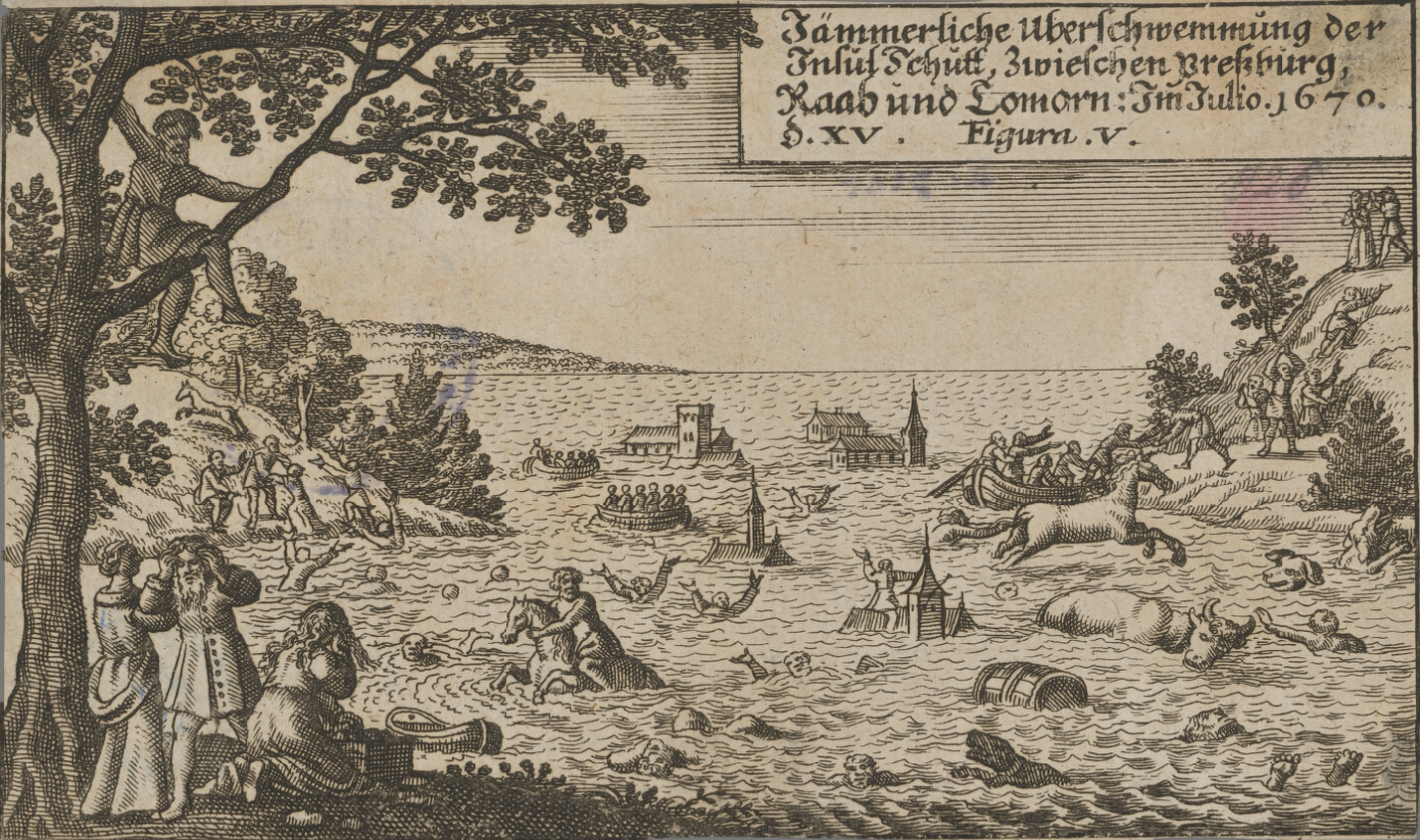
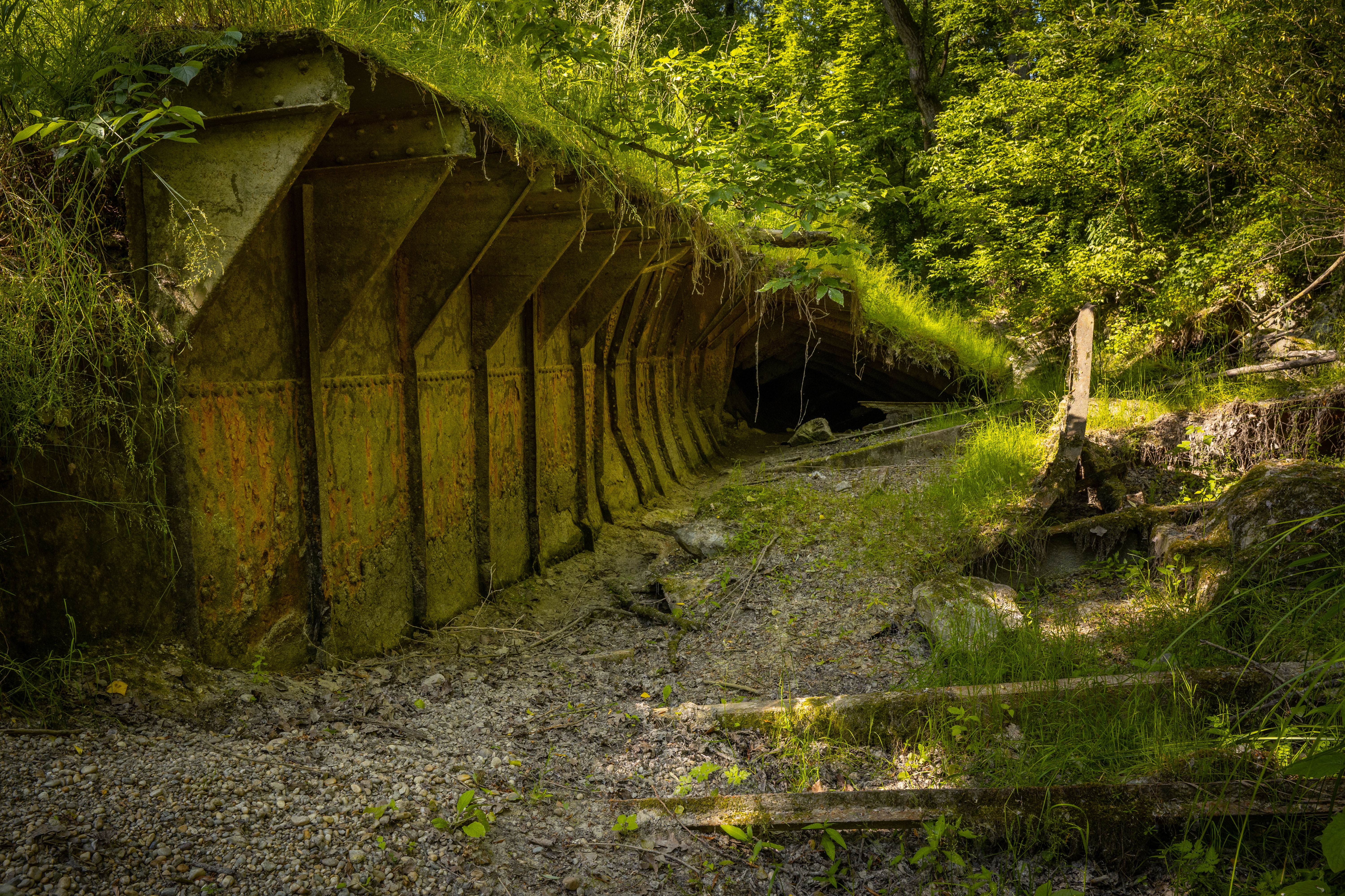
Flooding was not an unfamiliar phenomenon to the residents of the region, as for centuries they had been forced to adapt to the whims of the Danube. As the river exits the Dévény Gate and enters the Little Hungarian Plain, it sheds its Alpine character and, through the sediment it deposits on the flatlands, shapes the areas known as Szigetköz and Csallóköz.
Before the major river regulation works of the 19th century, we cannot speak of a fully unified geographical area, but rather of a dynamically shifting system of islands. Historical records tell us that life for the people living along the Danube was a constant struggle against the water—but they also knew how to harness its benefits. 1
In flood-prone areas, a form of floodplain farming was practiced. So-called "foks" (sluice-like openings) were built into the levees, allowing floodwaters—occurring two or three times a year—to inundate meadows and orchards. This not only enriched the soil with nutrient-laden silt but also provided spawning grounds for fish. The main sources of livelihood for the population were livestock farming, fruit cultivation, and fishing. 2
“In the 19th century, more serious riverbed regulation works commenced, and in the 1880s and 1890s, approximately 2 million cubic meters of stone were used to reinforce the banks of the Danube’s current main branch, which, according to the Treaty of Trianon, became the state border between the two countries. This effectively closed off many side arms, creating the main shipping route. Since the river was confined between embankments, the floodplain was compressed as well. The consequence of this was a rise in flood levels. Because these were rather rudimentary embankments, when they breached, the water flooded areas that had not been inundated before.”
This information was shared with us by Béla Angyal, an ethnographer and historian, who, although a child at the time, also personally experienced the 1965 disaster.
“The way of living with water is also evident in the construction of wattle-walled houses, which meant that even if floodwaters inundated them and washed away the mud at the base of the walls among the wattle, it could be patched up and made habitable again. Brick and adobe houses only became widespread at the end of the 19th century and the beginning of the 20th century. The villages in the region generally originated on slightly higher ground. Although the area appears flat, there are elevation differences—for example, between Upper and Lower Csallóköz there is a 30-35 meter difference, and locally there are variations of 2-3 meters. These areas are primarily those close to the rivers, as the heavier sediment was deposited there during floods. Moreover, when building, the area under the residential houses was always raised by 2-3 meters, enabling people to live in harmony with the water.” - Béla Angyal explains the old Csallóköz inhabitants’ relationship with water.
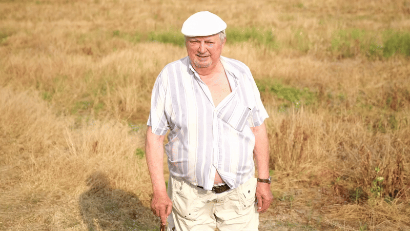
In a similar way, 90-year-old Nándor Kiss, born in Kolozsnéma into a miller and sailor family, also told us about this coexistence.
“For the elders, it wasn’t such a huge act of God. In the old days, the Danube would change its mind and flood. My mother told me that the boat was always kept in the yard. They never knew when the flood would come. The animals were kept on higher ground, so they survived. Back then, floods weren’t as severe because the embankments weren’t as high.”
The Hundred-Year Flood
In earlier times, the main problem was winter ice floods, which caused the greatest destruction. However, in the first half of the 20th century, there were no major floods on this stretch of the Danube. After World War II, the two cooperative-based organizations - the Upper Csallóköz Flood Control Association and the Lower Csallóköz and Csilizköz United Flood Control Association - were dissolved. Instead, water management organizations were established at the district level, fragmenting the territory, even though the river flowed through multiple districts. According to an interview conducted by Béla Angyal with water engineer László Décsi, communication between these organizations was insufficient.
Another problem was that during this period the Danube’s riverbed had significantly silted up. During and after the war, little time and resources were available for maintenance or dredging beyond removing wreckage. In 1954, a flash flood broke embankments at Kisbodak, Dunakiliti, and Ásványráró. Approximately 550 million cubic meters of water flooded the settlements in the Szigetköz region, forcing 30,000 people to abandon their homes. 3
A little over a decade later, the situation was different. A flash flood, as its name suggests, is nearly impossible to predict, but the spring of 1965 was unusually rainy. From March onwards, several consecutive flood waves moved along the Danube. Due to a sudden rise in temperature, the unusually large alpine snowpack began to melt, worsening the situation. At the same time, the Danube could no longer absorb the flood waves from its tributaries, causing the Váh and Morava rivers to back up. Construction was ongoing on the main canal leading toward Komárno and Aszód, and blockages in the canal bed also hindered the drainage.
At a closed meeting, the District Flood Protection Committee decided that Komárno must be protected at all costs, so if the Danube’s water level reached 840 centimeters, the embankment would be artificially opened at Zsitva. The surprise was even greater when, on the morning of June 15, news arrived that the Danube had broken through the embankment itself, roughly at the planned location between Pat and Zsitva. The breach was not even attempted to be closed because, firstly, the population in the area was not threatened by flooding, and secondly, the terrain naturally slopes toward the Danube riverbed, so after the flood wave passed, gravity would take care of draining the water.
The true catastrophe happened only two days later.
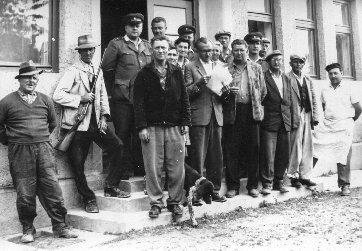
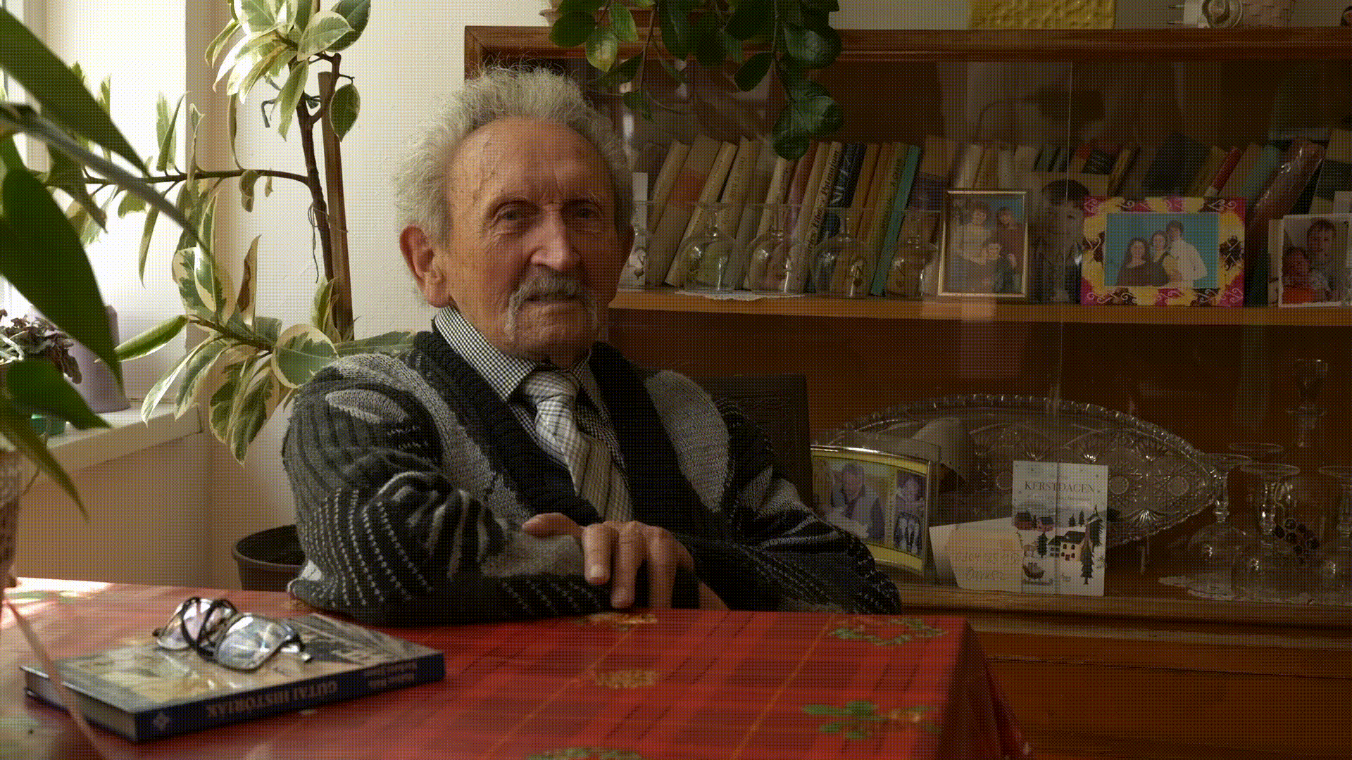
“The atmosphere was peculiar at the time because the first half of 1965 was very tense due to the high Danube water levels. This was basically the main topic of conversation among the people. In the evenings, they would go out to the embankment to see the enormous volume of water the dams were holding back. There was great concern. In the final days, organized workgroups regularly went out in the village to plug the so-called ‘springs’ near the embankments.” – Tells us Sándor Gaál, who was an employee of the Kulcsod Agricultural Cooperative when the disaster occurred.

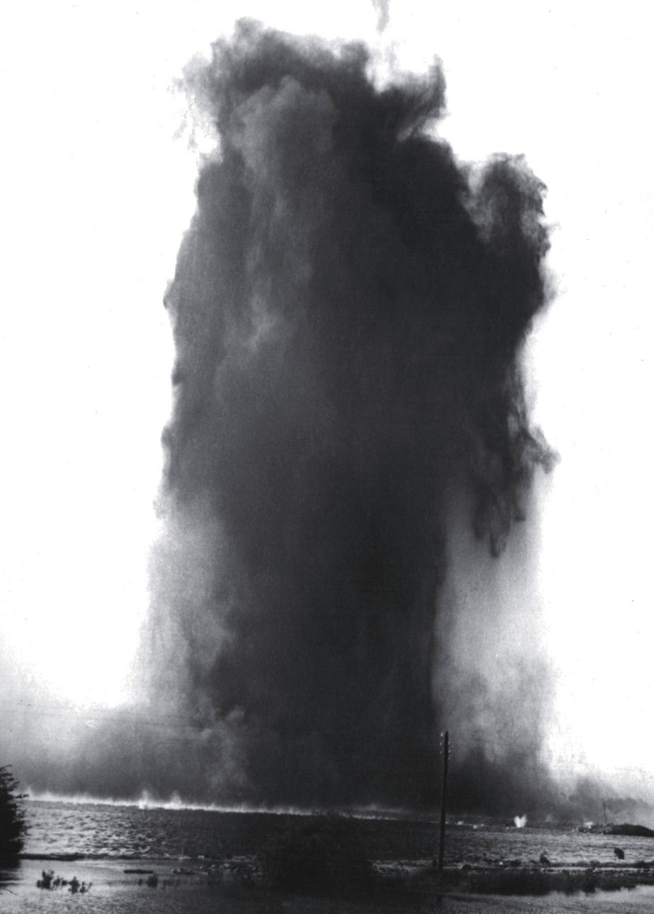
In the technical literature, the leaks that break through on the landward side of the embankment during floods are called “springs” (buzgár). These were already observed on the protected side in the second half of May and gradually increased in number over time. Along the 144-kilometer-long embankment section, a total of 2,312 such springs were recorded, some located as far as 350 meters from the embankment. 4 Near the boundary of Kulcsod and Csicsó, in the area locally known as Ladocsi ramp, this problem became increasingly severe and was not handled properly, causing the pressure on the embankment to rise further.
Properly, a so-called counter-pressure basin should be built from sandbags to contain the springs until the pressure is equalized. On the early morning of the 17th, a turbid-water spring was detected two meters from the embankment at the site, followed shortly by another nearby. The soldiers working there attempted to plug them with sandbags, but these were pushed back. Soon, on the other side of the embankment, in the flooded floodplain forest, such strong whirlpools formed that they uprooted trees and swept them into the flow. There was no turning back.
“On the 17th, I was specifically at the collective farm when one of the farmers came in from the embankment and said there was a big problem — they couldn’t plug one of the springs, and it was erupting like a geyser. Around half past ten, the terrifying news came that the embankment had broken and the water was coming toward the village. Within an hour or two, the farm below the village was already reached by the water, and by evening, the houses were collapsing.” – Sándor Gaál continues his recollection.
Legend: Break locations ︎︎︎ Pumping stations ︎ Areas that remained dry ◆ Openings in the Váh-Danube embankment ▼
The initial breach, which was 10 meters wide, soon widened to 85 meters. Estimates suggest that water flowed out onto the protected side at a rate of 1,400 cubic meters per second. Feverish work began throughout Csallóköz. 5 The evacuation of people and livestock to higher ground was underway. The residents of Kulcsod were the first victims of the flood wave, as the water reached the lower-lying houses within half an hour. Sándor Gaál, together with the other members of the cooperative, tried to save what could be saved:
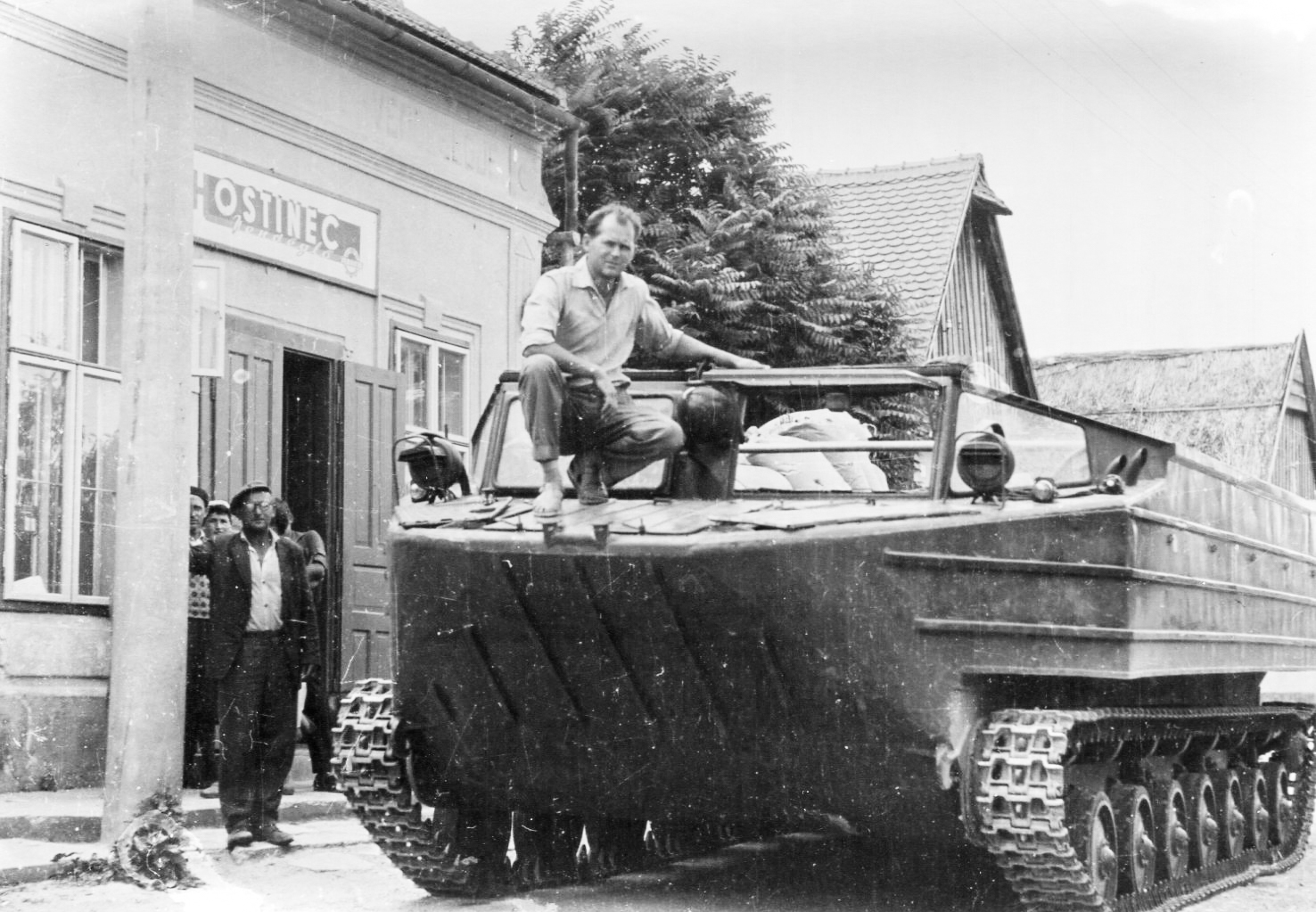
“My first task was to save the farm animals from the cooperative yard. We had a few draft horses, which we set free. By then, the Soviet amphibious vehicles had arrived, and we had to load the fattening cattle onto them. We waded up to our waists in that filthy water. We released the animals and pulled them onto the amphibians. Two barns housed milking cows; those were driven to Albár and Kürt… It was a very lively time, very busy, exciting, and full of anxiety… The people who took care of the animals naturally went with their own animals too, because those also needed tending. Meanwhile, another group of workers went to higher Slovak territories to secure winter fodder, as everyone expected that this would end one day and the animals would return. A significant work group went to cut and collect hay, all of which was transported home by train.” Only a few people stayed behind in the villages voluntarily.
“The next day, a helicopter landed in a large yard at the highest part of the village and from there it transported people away. One of the darker entertainments was listening to which part of the village a house would collapse in next.” – adds Gaál Sándor.
An extended stay
Not everyone experienced those days as gloomy. Children were typically taken to pioneer camps in the Czech Republic and northern Slovakia. Our interviewees, who were young at the time of the disaster, almost unanimously remembered it more as an adventure. Szerénke Keszegh Nagyné was 10 years old then and recalled the summer of ’65 as follows: “As a child, I didn’t feel the weight of the flood. I didn’t even know what it was. I grew up on the canal bank; water was absolutely my friend. The duck and I swam the most… We attended school in shifts at Csilizradvány in an alternating schedule. I was getting ready to go to the bus when the loudspeaker announced there was an emergency. The children and the elderly had to go into the village as evacuation began… Grandpa lived at home with us. Dad worked in Bratislava, carrying gravel. Mom was at home as a housewife; my older sister was at school because we had alternating shifts, and I had a four-year-old little brother. My little brother stayed at home with Mom. I led Grandpa into the village. Buses came one after another and took us to Nagymegyer… Grandpa was very poor-sighted then, so I guided him. The school from Csilizradvány was also relocated there, so I met my sister. We thought Mom would surely come and she did, with packages. She was so thoughtful, she baked bread at home—the round, huge loaves—and brought a whole ham. The whole village had dinner together. Even then I didn’t think this was a disaster. I don’t know how many days passed because I felt good. Later, they took us to Egyházkarcsa. Dad went with the cooperative to Martin to take care of the cattle, and Mom collected hay for the cows. My little brother was placed in an orphanage, and we cried a lot afterward because he wasn’t with us. They took us to Vágújhely, where there was a pioneer camp. There were many children there—kids from Csilizradvány, Nagymegyer, Ekecs, Kulcsod… We got everything from pajamas on. Our teachers from Csilizradvány were with us, taking turns, so there was always supervision.”


Struggle Against the Elements
Meanwhile, the water pressed on, unstoppable and relentless. Around towns and villages, with the aid of the military, men built makeshift embankments — so-called “extended dams” — which proved effective in protecting much of the higher ground settlements like Nagymegyer, Ekecs, Apácaszakállas, and Nemesócsa. Komárom was saved by transforming the railway embankment into a temporary dam, yet it became unreachable by land. In Csallóköz, the land slopes downward from west to east, and Gúta — then the most populous village in Czechoslovakia — lay precariously at its southeastern edge, making it the most threatened by the rising flood. Two days after the Kulcsod dyke burst, the construction of the extended dams began here under the guidance of engineer László Décsi. But a cruel misunderstanding doomed their efforts from the start.
As Béla Angyal recounted the grim scene: “There’s a small ridge running through Lower Csallóköz along the banks of Császta and Dudvág rivers, slightly higher ground. Décsi’s team marked a line on the map for a circular dam. They agreed that part would be built by the military, the other part by the people of Gúta under Décsi’s supervision. It looked like they’d finish on time — but then the water came, breaking through. The plan was for the military to build from Királynérét station toward Gúta, and the locals to build downward from there. But when Décsi finally arrived, he realized the military had been gradually extending the existing embankment and hadn’t reached the station yet. Meanwhile, the people of Gúta had built the dam continuously along the entire line, gradually raising it. So the water broke through between the two dams at Királynérét.”
Despite the Gúta villagers working day and night, promised machines never arrived, and there weren’t enough hands along the dam. Thus, among all the settlements in Csallóköz, Gúta suffered the greatest devastation.
“What I saw was beyond belief—the flood had swept away the split firewood, and the entire yard looked as if it had been freshly parqueted by the water’s hand. I stepped inside, but the house was empty—no one was there.”

“I had my camera with me because I had taken a few shots earlier, but not at that moment. Not far from here, a small haystack was floating on the water. On one side of the haystack sat a fox, and on the other, with its back turned, a rabbit. I was wondering who was luckier — since the rabbit had food, but so did the fox. It would have been an amazing picture, truly sensational.”

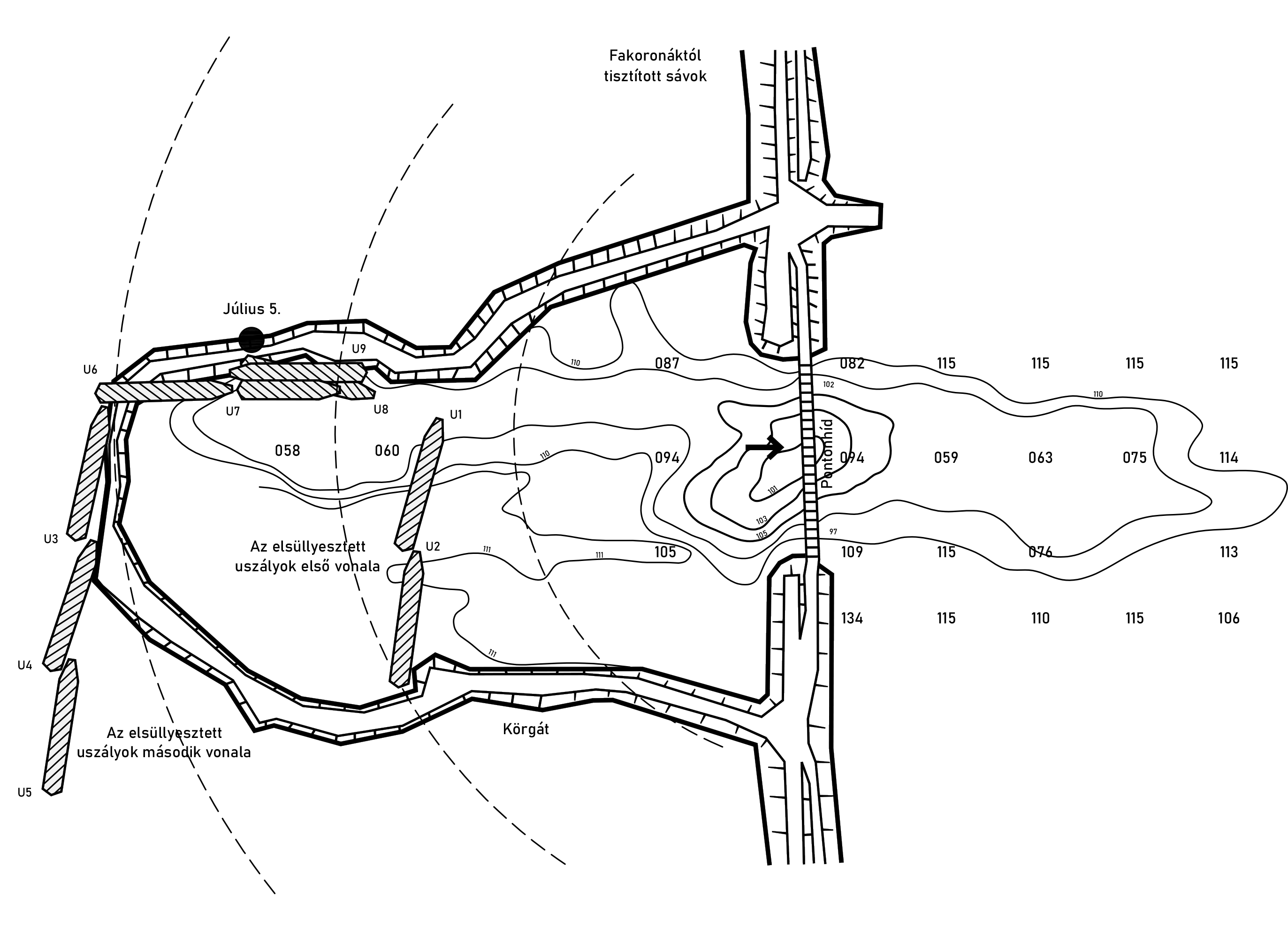
However, construction of the stone embankment was suspended for three days because, along the designated route in the floodplain, the river’s current had carved out pits up to 15 meters deep in places. This forced a change in the ring embankment’s alignment to allow filling in shallower areas. Work resumed on the afternoon of June 24.
Although the new alignment and reduced depth provided better conditions, the newly built sections were still threatened by strong currents. The deep hollows formed along the flow caused the water to erode and spread the embankment laterally. At this point, the leadership realized that the previous patchwork filling method was untenable and devised a new strategy: to redirect the Danube’s powerful current back into its original channel.
To achieve this, they constructed a protective embankment using three sunken barges. The gaps between the hulls were sealed with sandbags, creating a temporary hydraulic structure capable of breaking the force of the current. 6
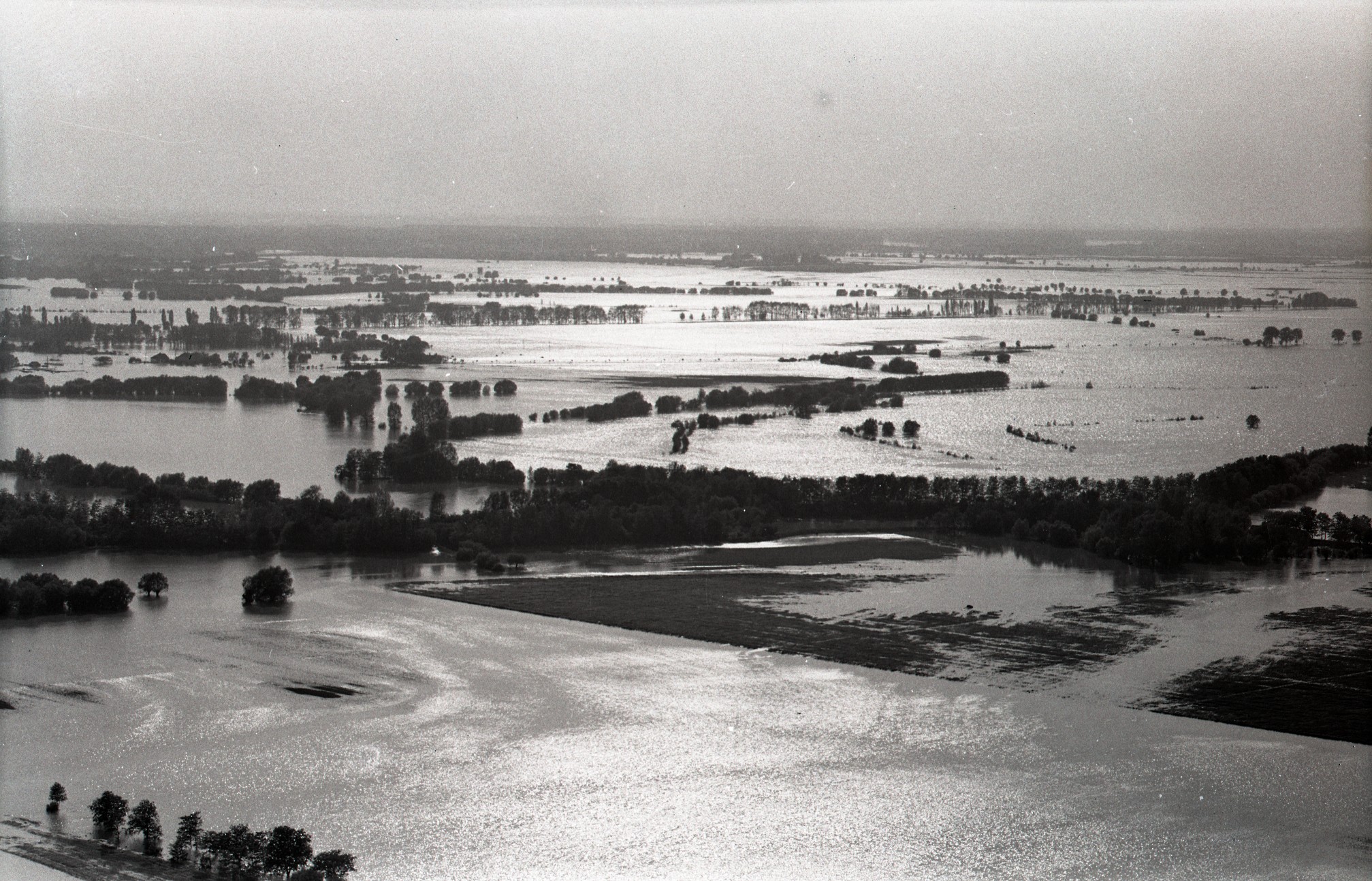
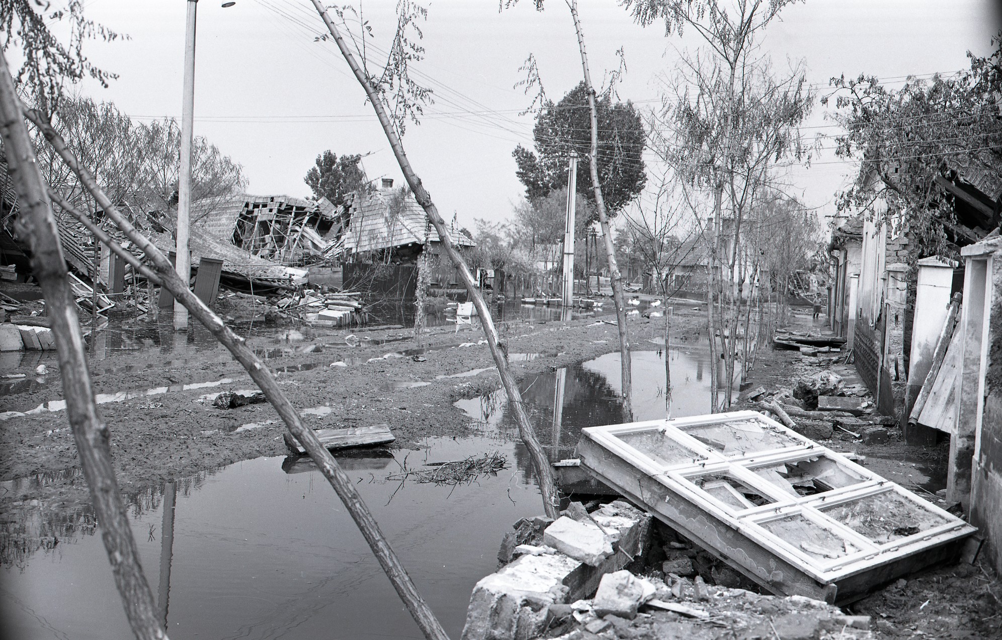
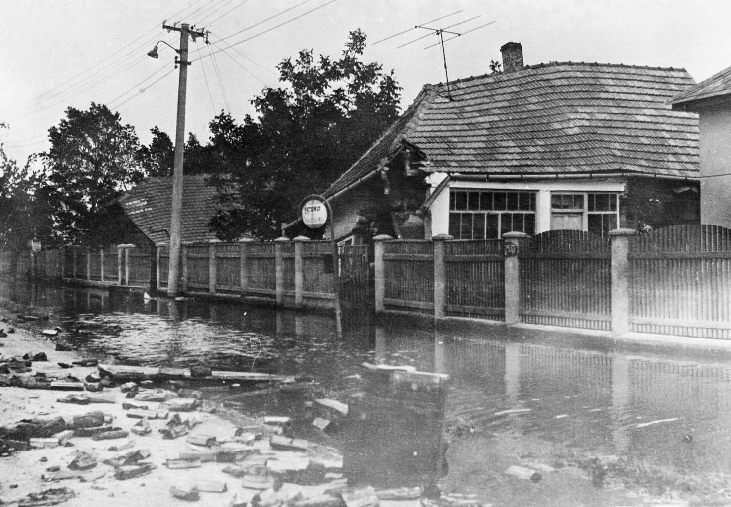
Finally, after 18 days and thanks to the daily work of 1,500 to 1,800 people, the flow was completely stopped on July 5. During this time, approximately 1.1 billion cubic meters of water poured into the Csallóköz region, flooding 72,000 hectares. The breach absorbed 52,000 cubic meters of stone, equivalent to the load of 13,000 trucks. A total of 3,910 houses were destroyed, and another 6,180 were damaged to varying degrees. 7
Flood protection work continued until the second half of September, except for a few isolated lowlands. After the flood receded, the Vág-Duna embankment had to be blown up in three places to accelerate water drainage. Meanwhile, the military, together with a team of civilians and veterinarians, carried out disinfection and dealt with thousands of dead animals.
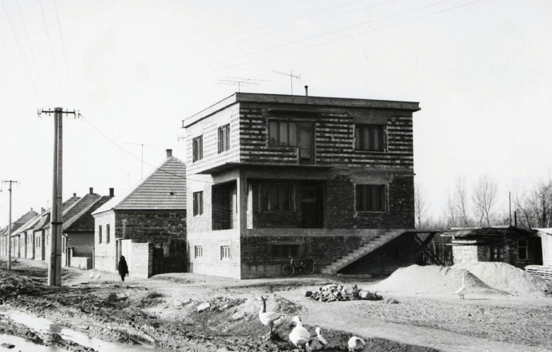
To start over
“At the end of August, they put us on a bus; everyone could take the clothes they had been given, and they brought us home. That’s when the certainty struck me — home? Where to? There was no house. It had collapsed… When I saw the house, or rather the place where it had been, it was very hard.” – Nagyné Keszegh Szerénke tells us what it was like to return home.
Not every school-aged child was as fortunate. Due to its location and flawed flood defenses, Gúta suffered the greatest damage. The school-aged children there could only return home a year after the dike breach. Parents were transported monthly by bus to visit their children.
“By Christmas, most people were already living in their houses. The reconstruction went very quickly. The state also provided funding. Rumor had it that those who had worse houses before were allowed every year on the 15th to go and kiss the dike. The water didn’t take away their homes—it actually brought something to them.”
István Mátis, who could only come home on weekends to help his parents, gives a similar account of the reconstruction: “We moved out the furniture, tore up the floor, and stripped the plaster. Although the water didn’t rise very high, the walls absorbed it and were completely soaked up to about two meters. Fortunately, my parents had a small summer kitchen beside the house, where they slept until we fixed the house. I did the masonry work with my father, but they did receive some compensation. However, there were people—whom I don’t envy—whose houses were worth nothing, but they got much more compensation and even a new house. But of course, they went through a bigger trauma—they lost their home. We had somewhere to live. In Balony, there were only a few such brick houses.”
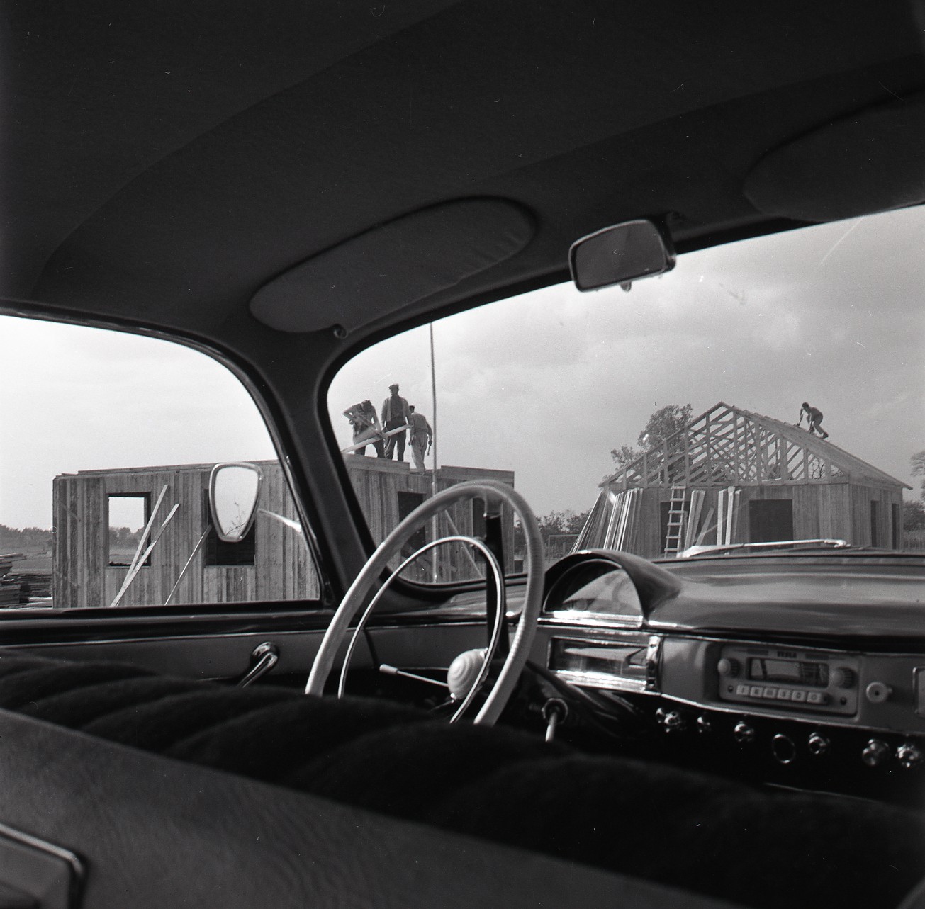
The flood had perhaps its greatest impact on architecture and the appearance of settlements. The reconstruction significantly accelerated processes that the communist regime had already been promoting nationwide. The best example of this was the case of Gúta. During the rebuilding, instead of the traditional adobe houses typical for the entire Csallóköz region, standardized model houses were constructed—houses that still define the look of the local streets today. The rural homesteads practically disappeared, fully absorbed by agricultural cooperatives. In many places, sewage systems were installed, and most streets were paved at this time. Thanks to the locals’ heroic resilience and large-scale infrastructural developments, Gúta was later designated a market town in 1967. 8


We thank all our interviewees for their contributions and kind cooperation. We are also grateful to Béla Angyal, the Gúta City Office, and the First Pest University Radio.
1 Földes Gyula-Rudnay Béla: Csallóközi Kiskönyvtár - Két könyv a csallóközi árvédekezés történetéről (Felső-Csallóköz árvédekezésének története; Ismertetése az Alsó-Csallóköz és Csilizköz ármentesítésére, valamint az Alsó-Csallóköz belvizeinek rendezésére vonatkozó terveknek és munkálatoknak, (Kalligram Könyvkiadó, 1999)
2 ANGYAL Béla: A gútai ártéri tanyák és az ártéri gazdálkodás (Ethnographia, 1994)
3 Özönvíz szigetközben, dunaszigetek.blogspot.hu
4 Ihrig Dénes (szerk.): Dunai árvíz 1965. Vízügyi Közlemények. 1966
5 Angyal Béla: Az árvíz – Gúta, 1965-1966 (Fórum Kisebbségkutató Intézet, 2015)
6 Ihrig Dénes (szerk.): Dunai árvíz 1965. Vízügyi Közlemények. 1966
7 Angyal Béla: Az árvíz – Gúta, 1965-1966 (Fórum Kisebbségkutató Intézet, 2015)
8 Angyal Béla: Az árvíz – Gúta, 1965-1966 (Fórum Kisebbségkutató Intézet, 2015)
Further references used:
Ján Szolgay, Štefan Hronec, Július Knižka, Karol Zmeškal, Gustav Zatkalík: Povodeň na Dunaji v roku 1965 (Pallas 1969) František Hegely: Podunajská kronika 1965 (Okresný výbor Komunistickej strany Slovenska Komárno)
Ihrig Dénes (szerk.): A magyar vízszabályozás története (OVH, Budapest, 1973)

This content was published as part of PERSPECTIVES – the new label for independent, constructive and multi-perspective journalism. PERSPECTIVES is co-financed by the EU and implemented by a transnational editorial network from Central-Eastern Europe under the leadership of Goethe-Institut. Find out more about PERSPECTIVES: goethe.de/perspectives_eu.
Co-funded by the European Union. Views and opinions expressed are, however, those of the author(s) only and do not necessarily reflect those of the European Union or the European Commission. Neither the European Union nor the granting authority can be held responsible.